Contents
Index
Add Connections from Road
This option will generate across road connections and connect them to points on the other side
of the road to increase connectivity in a network.
The first connection is added at the second point and it works Clockwise from point to point
until it reaches End Point. The last connection is on the 2nd last point.
Note: The other side of the road must exist to use this option.
Select this option from the "Extra Tools" list.
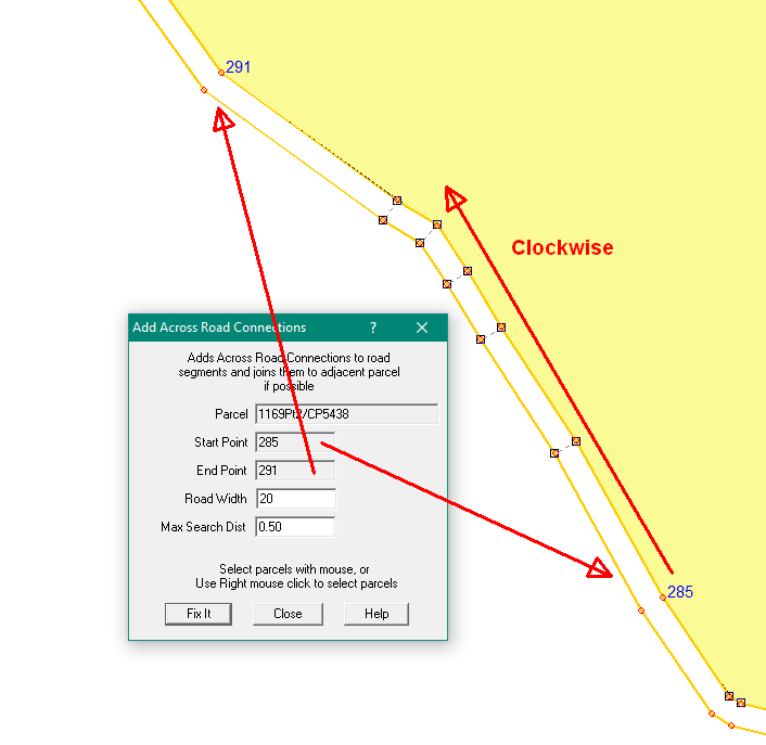
Parcel
Click on the parcel with the road frontage using the mouse.
Start Point
Click on the start point of the road that you want to fix.
The first connection will be added at the next point.
End Point
Click on the end point of the road that you want to fix.
The last connection will be added at the previous point.
Road Width
Enter the road width.
Max Search Dist
Enter the max search dist to match points for connections.
Fix it
The program will walk along the road and at each IP it will project a connection
across the road (using Road width) and search for a nearby point (within max search dist).
If found, the connection will be created to the point on the other side of the road.
If not found, no connection will be created.
To include this Tool in Geocadastre, there has to be the following entry in the MenuColumn section of the Config file.
menuEntry menuText="Add Across Road Connections" menuItem="MENU_ADD_ROAD_CONNS"
The change to the config file can be made using a text editor.